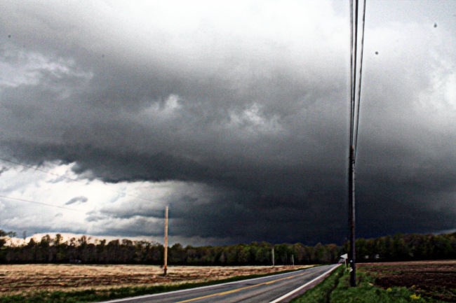
As you know, I love to document ALL weather events, thunderstorms, ice jams, wind, snow, etc. 2014 has been a busy year documenting snow and ice. However, thunderstorms have been off to a slow start. A cold spring and most of the Great Lakes being covered in ice hampered any chance of severe thunderstorms. Finally, on May 12, 2014, I got my first chase of the season in. It looked promising at first. A line of strong storms were moving across Ohio into PA. I made a trip up to my favorite vantage points at State Gamelands 95 to document conditions. Dew points were sufficient at 63 but for some reason, the storms weakened and all I got was moderate rain. The only decent structure shot I got was a rain cell moving across the Butler/Venango County line. The rain eventually let up and the sun came out. I was hoping for a rainbow but didn’t get to document one. My first chase was a bust but at least I got to get out and try out my equipment. And I got a muddy car,lol.
May 14, 2014. What a day that was. Warm temps of 77 degrees felt so good with dew points at 63. Thankfully, I had childcare and was able to chase this amazing setup. The day started out as a “blue sky bust.” Storms were raging in Ohio and some even had tornado warnings on them. Most of Ohio was under a tornado watch. Storms in Ohio moved from south to northeast. From State Gamelands 95, I could see the towers in Ohio. I sat at the gamelands for an hour checking radar constantly. Around 6 pm, I saw some cells forming in Beaver County. Their trajectory was south to northeast. I repositioned north into Mercer County. I intercepted 3 storms that evening. The first severe storm moved through Grove City, PA. I positioned myself southeast of the storm along state route 58. Luckily, I found a place to pull over. That storm had a triangle shape to it. High winds were a concern.
The second storm was severe warned. I repositioned again along state route 258 in North Liberty, Mercer County. According to radar, the storm was moving towards “the cross.” The cross is where Interstate 79 and Interstate 80 meet. It looks like a cross on the map. Again, I positioned southeast of the storm. Beast describes this storm. 60 mph winds and pea size hail were associated with it. I measure 11 mph winds with my anemometer. Looking west, I noticed a wall cloud with rotation. I watched that area closely. After a few minutes, it dissipated. One of the best shelf clouds I have ever seen was visible with this supercell storm. It was amazing watching the storm go by and seeing the sunset at the same time. This chase provided some of the most photogenic storms of my chasing career.
Storm number 3 was seen from a distance. Back in Butler County, I watched as this severe storm moved through Lawrence county. The amazing thing about this storm was I got to document lightning along with the sunset. It was such a neat sight to see. Just as the sunset, I called it a night as storms were fizzling out and it was a school night for my son. What started out as a disappointing day turned out to be one of my best chases.
Monday, May 12, 2014. Here is the rain showers that were moving across the Butler/Venango Co. border. The sun popping out made a nice contrast. BTW, here is my chase vehicle/family car.
Probably one of the most photogenic storms I ever documented. I was in perfect position, around 3 to 4 miles away.
Storm in HDR. It was very impressive. And I didn’t even get wet on this chase,lol. I try to stay out of heavy rain if possible.


